Aldabra, Assumption put in high biodiversity areas for Seychelles' marine plan
General |Author: Salifa Karapetyan Edited by: Betymie Bonnelame | October 9, 2017, Monday @ 11:00| 7635 views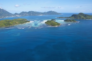
The Seychelles’ Marine Spatial Plan is an initiative that looks at the management of all the different uses of the island nation’s Exclusive Economic Zone. (Gerard Larose, Seychelles Tourism Board)
(Seychelles News Agency) - Areas around Aldabra Atoll, a UNESCO World Heritage site, and the Assumption Atoll have been drafted as zone one areas — high marine biodiversity protection areas - under the Seychelles’ Marine Spatial Plan phase one presented on Friday.
Discussions involving the management of the plan took place last Friday and looked at areas that will fall under zones one and two, and corresponding activities that will be allowed in each zone.
“We also looked at the conditions that come with these zones through the allowable activities and the management consideration,” said Helena Sims, the project manager of the plan.
The Seychelles’ Marine Spatial Plan is an initiative that looks at the management of all the different uses of the island nation’s Exclusive Economic Zone [EEZ]. At the same time, it will be promoting the Blue Economy agenda of the country, allowing for sustainable development, food security and economic prosperity.
The project, which started in 2014 and ends in 2020, has as the target of identifying 30 percent of the Exclusive Economic Zone for protection and management.
Zone one has been demarcated as ‘high marine biodiversity protection’ which aims at increasing areas of protection and conserving unique biodiversity.
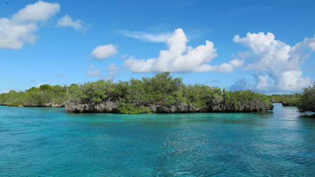 |
| Areas around Aldabra Atoll and Assumption Atoll have been drafted as zone one areas — high marine biodiversity protection areas. (Seychelles News Agency) Photo License: CC-BY |
Zone two called the ‘medium biodiversity protection and sustainable use’ areas, will target the protection of marine biodiversity, seabed habitats and important growing ecosystem. Waters surrounding atolls in the Amirantes, Coetivy Island, and the Fortune Bank among others will fall under this zone, representing 10.8 percent of Seychelles’ waters.
Activities in zone one will mainly be orientated around tourism and recreational whereas zone two will also accommodate for fisheries, non-renewable resources and bioprospecting activities.
“The first milestone is that by this December we need to have a marine plan endorsed by the cabinet that identifies 15 percent of our EEZ for protection and management,” said Sims.
She added that “one of the benefits of the zoning design is that it will help us meet our commitments in terms of the convention for biodiversity target which is looking at 10 percent.”
While the percentage of protected areas on land is a little over 50 percent, marine parks and other conservation zones constitute less than 1 percent of the Exclusive Economic Zone of Seychelles spread over 1.37 million square kilometres.
Tourism and fisheries are the two top contributors to the economy of Seychelles, an archipelago in the western Indian Ocean, which has a total land area of 455 square kilometres.
In the second phase of the project, additional areas in the Seychelles deep waters will be proposed as well as new areas for marine protection in shallow waters. Once completed, the Marine Spatial Plan will be the second largest in the world.